Waters
These maps show the extent of the bulk of our fishing.
GOOGLE MAP SHOWING THE FISHING, PARKING AND POOLS
========================================================================
Google Earth placemarks
To aid orientation: The following link should download a folder of Google Earth placemarks referring to various relevant sites and access points to our fishing on the Dart. Please note that these placemarks are provisional and no responsibility can be taken for their accuracy. Any suggestions for corrections gratefully received. You need Google Earth installed to view them. Once downloaded, just double click on the .kmz file and it should load itself into the temporary places folder in GE. The file contains a sub folder called ‘Dart Angling Association’. Drag and drop that into the ‘My Places’ folder. If you are replacing an older version of the file, delete the older one first to avoid duplicating placemarks.
Dart placemarks here
Holn Bridge to Holy Pool

Dart Bridge to Island Pool

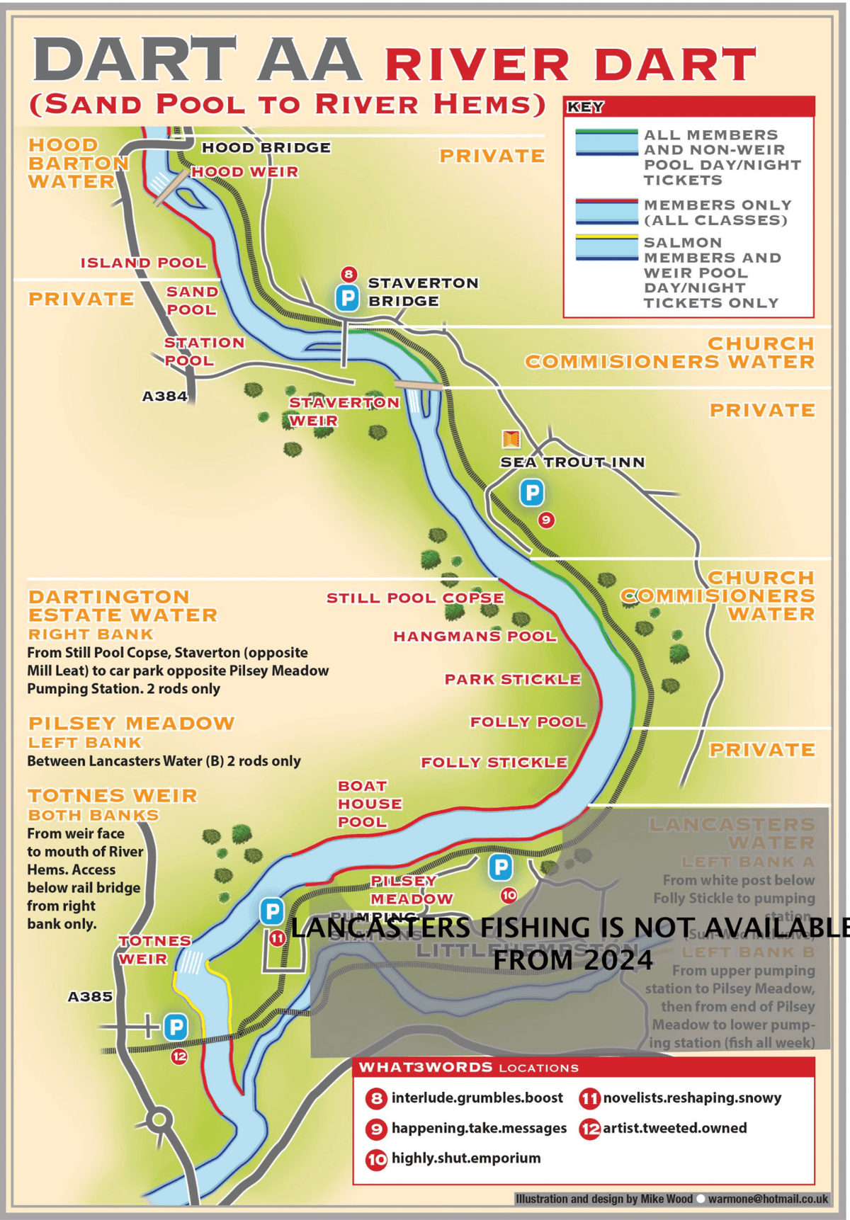
Sand Pool to River Hems
Legacy Maps Dart Gorge
Download PDF
The maps below (not to scale) show the extent of Association waters.
The map immediately below shows access to the Dart Gorge fishery, with a maximum of two rods. Fly only. Click through to see a detailed map of the fishery.
Legacy Maps
Download PDF
This map shows the bulk of our fishing a little further downstream. It is colour coded to show those beats which are available to members and those which are also available to visiting anglers on purchase of a day ticket. (Or night ticket in the case of Sea Trout fishing)
The following link should download a folder of Google Earth placemarks referring to various relevant sites and access points to our fishing on the Dart.
They should be used for orientation in conjunction with the maps.
Please note that these placemarks are provisional and no responsibility can be taken for their accuracy.
Any suggestions for corrections gratefully received.
You need Google Earth installed to view them.
Once downloaded, just double click on the .kmz file and it should load itself into the temorary places folder in GE.
The file contains a sub folder called ‘Dart Angling Association’.
Drag and drop that into the ‘My Places’ folder. If you are replacing an older version of the file, delete the older one first to avoid duplicating placemarks.
Dart placemarks here
If you do not have Google Earth, find out more and download it here

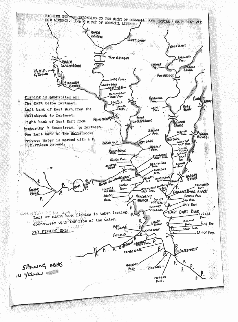
Pools New Bridge to Dartmeet
I have attached two maps. One shows pool names from New Bridge to Dartmeet. The other shows pool names on West Dart. Thanks to Dave French for these. They are not to scale and I can't promise they are complete but nobody knows the river better than him.
Giles

Pools on West Dart River
I

Duchy of Cornwall 1

Duchy of Cornwall 2
Download PDF
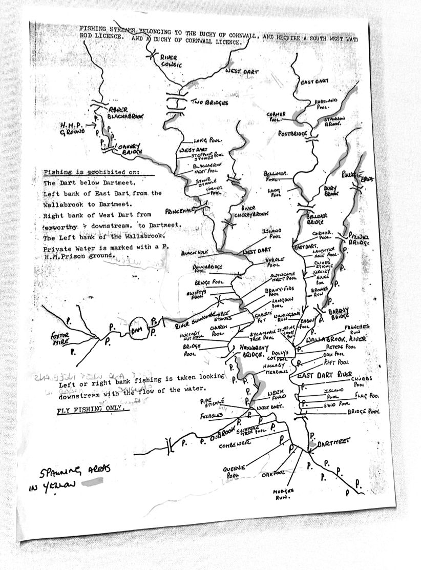
The document Duchy of Cornwall 2 (download and below) is purely for information relating to the names of specific pools. Please refer to Duchy of Cornwall website for the latest permissions / access information.
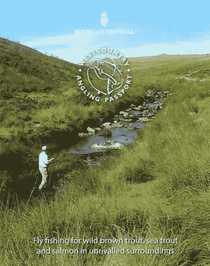
Duchy Fishing on Dartmoor
Access to the Duchy of Cornwall’s fishery on Dartmoor is included with DAA membership.
Association members may fish for all categories of fish in this fishery.
PLEASE NOTE – IF PARKING NEAR DARTMOOR TRAINING CENTRE, (CAR PARK 11 ON THE MAP), PLEASE USE THE QUARRY AND DO NOT OBSTRUCT THE TURNING CIRCLE WHICH IS REQUIRED FOR COACHES TO ACCESS THE CENTRE.
While the extent of the Duchy’s fishing is very large above Dartmeet there are stretches which are privately owned, notably the West Dart right bank from Hexworthy Bridge to Dartmeet and the East Dartleft bank frow Pizwell to Dartmeet. There is no access on short stretches of the Blackabrook, Cherry Brook and Swincombe.
The fishing on Duchy waters can be excellent when conditions are favourable, salmon fishing can be good, particularly in a prolonged wet spell in August and September when given good grilse numbers and the fishing can even be more favourable than the lower river. The fishing can be challenging even exciting and a fish running down the narrow West Dart in amongst the boulders a difficult quarry.
All fishing above Holne Bridge is of course fly only.
Sea trout night fishing is mainly confined to the lower West Dart particularly Queenie Pool to Brakey Furze and needs reconnoitring by day as the bank-side is rough and hard going in places.
Brown trout fishing, particularly on the tributaries such as the Cherry Brook, Blackabrook, Swincombe and the main EastDart can be excellent and brown trout over 3lbs have been caught over the years. Much has been written about brown trout fishing on the Duchy waters by angling writers such as Mike Weaver and Pete Tyjas and salmon fishing by Charles Bingham.
Map
Please take a look at these before visiting.
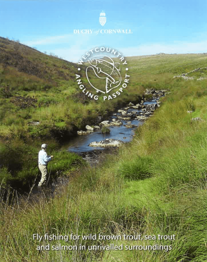
Map and description of waters
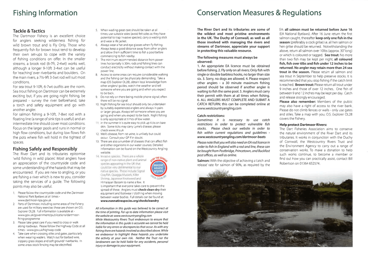
Fishing Information and Waters
Please take a look at these before visiting.
Fishing information, regulations and conservation measures
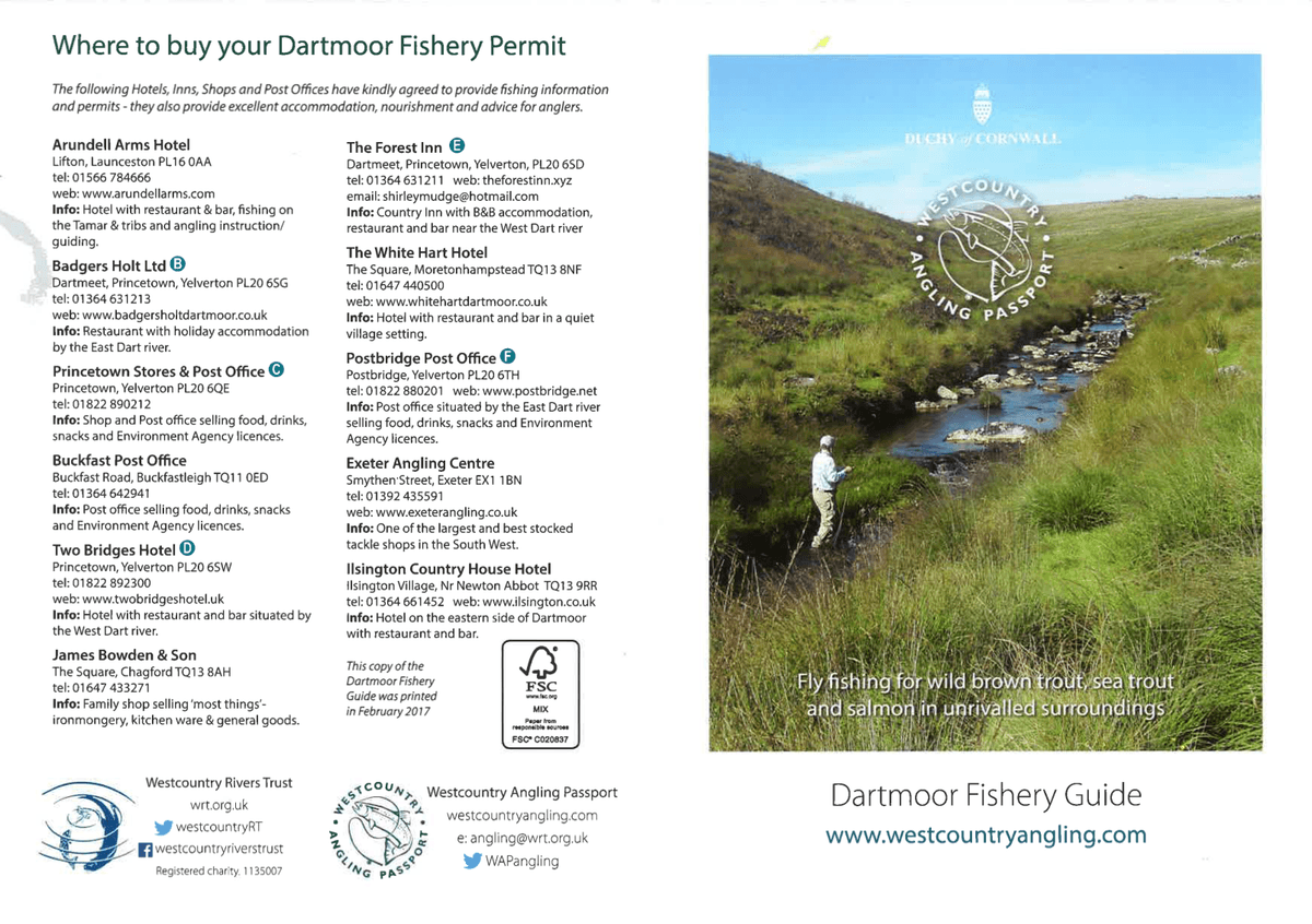
Where to buy guest tickets
Please take a look at these before visiting.
Where to buy guest/non-member tickets for the Duchy water (usual DAA guest arrangements not valid here)